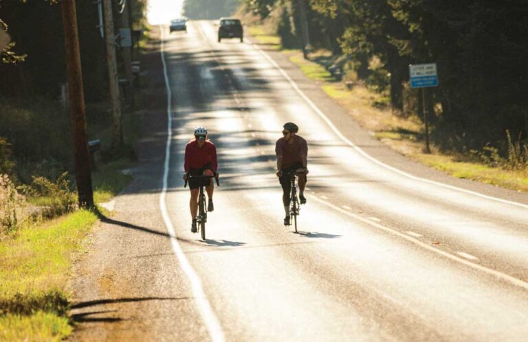
Look at the Island County cycling map and find a ride that suits you best.
Whidbey Island is fast becoming one of Washington State’s most popular cycling destinations. Rolling hills, coastal views, and cozy waterfront towns attract traditional and e-bike riders alike.
It’s certainly on my priority go-to list.
I recently smoothed out a paper copy of “A Bicyclist’s Map of Island County” across the kitchen table and studied my options. Should I explore the secluded back roads south of Clinton or follow Madrona Way along the Penn Cove shore from Coupeville to Oak Harbor? Do I want to take it easy or push myself?
The color-coded map illustrating recommended roads, traffic levels, and hills helped me decide. When I needed bike lane information, it was there. When I wanted to locate the hills, arrows on the map pointed the way. Major and minor roads, neighborhood streets, and multi-use paths are also marked.
I eventually folded the map with a plan in mind. I would ride three times to experience a little of everything. There’s an easy, flat ride, rolling countryside to the south, and a challenging trip with frequent short yet steep grades to test the legs.
Here’s what I found.

Easy and Flat
I drove my car from the Portland-Coupeville Ferry and parked in an adjacent lot just east of the dock and pedaled away along Engle Road, a busy road that provides ample shoulders for safe cycling. I considered a quick spin through Fort Casey State Park but instead opted to aim toward Coupeville. It’s a straight line and 4 miles to town when staying on Engle Road, but I deviated from the plan and turned onto Hill Road. It was a good move. I quickly discovered stunning water views as the road began to tilt downhill to Ebey’s Landing Reserve.
The ride continued along Ebey’s Landing Road, past farm fields straight into town. I made my way into the heart of Coupeville. There I had to make another difficult decision: Kapaw’s Iskreme on Front Street or fresh-roasted Beaver Tales Coffee at the end of the pier.

A Rolling Loop
Looking for a longer ride with a little more variation, I took a 25-mile ride along back roads from Langley, through Clinton, and across the island’s south end. The rolling hills kept me pedaling up and gliding down as I wandered past forests and open fields before returning to Langley. An e-bike would make this even easier.
Here’s the Test

Saratoga Road north from Langley provided the island’s most challenging hills. These were not long mountain climbs, but I became weary with the series of short, testing bumps. This would be an excellent ride for those who ride e-bikes or like to climb. On this day, I was neither. Had I wanted more, I could have tried Brainers and Amble roads. The map showed more hills, however, and I had had enough.
Exploring Whidbey & Camano Islands by E-Bike
Why Ride Electric?
Scenic views, rolling hills, and artful stops are even better with a little boost.
Make the Hills a Breeze
Conquer climbs with ease— especially on hilly stretches like Saratoga Road or the countryside near Clinton. E-bikes smooth out the ride, so you can enjoy the journey without exhaustion.
Go Farther, Discover More
Hop from beach parks to farm stands to cozy cafés—all in one ride. E-bikes extend your range, helping you fit more into your island day.
Perfect for All Riders
E-bikes make group rides easier. Whether you’re a seasoned cyclist or just along for the fun, everyone can keep pace—and keep smiling.
Travel Greener
Reduce your carbon footprint while soaking in salt air and sunshine. E-biking is a planet-friendly way to tour both Whidbey and Camano Islands.
Ride Smart with a Local Map
Island County’s free Cycling Map shows shoulder widths, hill grades, scenic roads, and quiet back routes. Available at visitor centers, libraries, and whidbeycamanoislands.com/embrace
Pair with Free Island Transit
Avoid highway riding by combining your bike trip with Island Transit’s free bus service. All buses are bike friendly!
Plan your route: islandtransit.org

Where to Find Maps
The free bicyclist maps, produced by Island County Public Works, are available at island visitor centers, libraries, bicycle shops, and at the Island County Public Works office, 1 NE 6th St. in Coupeville.
Maps are also available by contacting the Embrace Whidbey and Camano Islands tourism office. (insert link – https://whidbeycamanoislands.com/embrace)

Catch the Bus
Busy highways 20 and 525 extend the length of Whidbey Island and are not considered safe cycling routes. Local bike riders dodge the danger by using Island Transit, the free, local bus service. Information is available at islandtransit.org.


