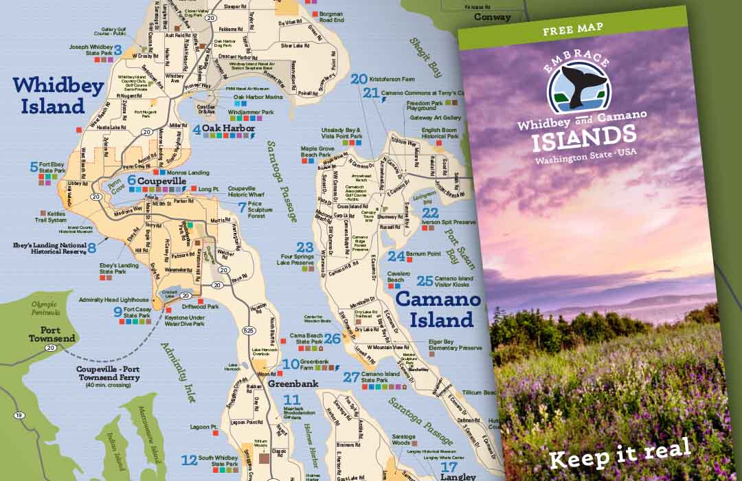
Skip to content
Whidbey and Camano Islands
  • Shopping
  • Things To Do
  • Events
  • Hotels
  • Restaurants
  • Ferries
Whidbey and Camano Islands

Map of Whidbey and Camano Islands

Map of Whidbey
and Camano Islands

This is the Official Visitor’s Map
for Whidbey and Camano Islands.

Our Comprehensive Map

Map Formatted for Easy Home Printing

  • Major Points of Interest
  • Boat Launches
  • Picnic Areas
  • Camping
  • Hiking Trails
  • Public Marinas & Docks
  • Off-leash Dog Parks
View Map for Download
Facebook FacebookInstagram Instagram
  • Subscribe to Newsletter
  • Contact Whidbey
    and Camano Islands
    Tourism
  • About Us/Meetings
    Agendas/Minutes
  • Privacy Policy
  • Things to Do
  • Events
  • Hotels
  • Restaurants
  • Island Notes
  • Marketing
  • Meetings on Whidbey
    and Camano Islands
  • Filming on Whidbey and Camano Islands
Logo says Whidbey Scenic Isle Way with a stylized drawing of Ebey's Landing
Whidbey and Camano Islands Logo

© 2025 Whidbey and Camano Islands

Scroll to top
Change Location
Find awesome listings near you!
  • Home
  • Stories About the Islands
  • Things to Do on Whidbey & Camano Islands
  • Culture and Heritage
  • 24 Trails
  • Shopping
  • Whidbey Island Ferry Schedules
  • Discover Your Islands
  • Hotels
  • Events
  • Maps and Itineraries
  • Islands FYI- Weather and Tides
  • Jets on Whidbey
  • Transformational Travel
  • In the News
  • Home
  • Things to Do on Whidbey & Camano Islands
  • Events
  • Ferry Schedules
  • Stories About the Islands
  • 24 Trails
  • Culture and Heritage
  • Hotels
  • Restaurants
  • Maps and Itineraries
  • Islands FYI
  • Jets on Whidbey
  • Transformational Travel
  • In the News
Search